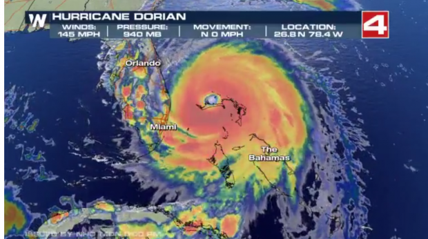
史上最强的飓风之一Dorin,目前在Bahama附近,未来路径将会横扫美国东海岸。
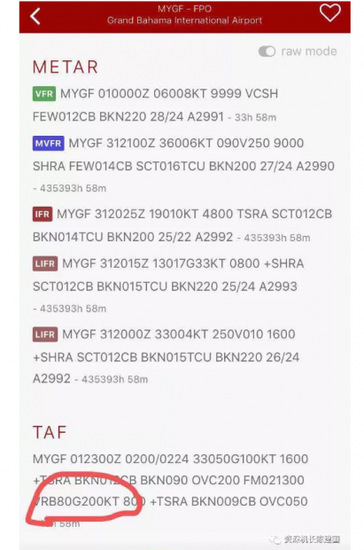
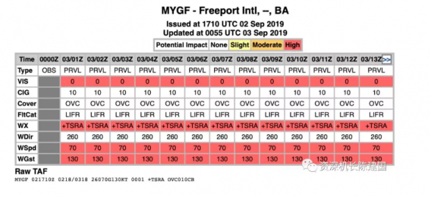
昨天飞行圈一个圈友发了发了一个机场Bahama机场预报,着实让人吃惊!
200kt相当于370公里每小时,比所有民航客机起飞和着陆的速度都大,也就是说把飞机放地上,就算全重,也能自己飞起来。而当前的风速也有130kts,也足够让大部分飞机起飞了。
而在Bahama(巴哈马),飓风造成的风暴潮超过6~8米,已经给当地造成很多灾难。巴哈马一个拍摄者在家里拍摄的二楼的情形。他估计水位在20~25英尺高。
截至目前,Dorin已经创下的气象记录:
Hurricane Dorian Meteorological Records/Notable Facts Recap
Valid as of 8pm EDT – September 2, 2019
Lifetime refers to storm lifetime through 8pm EDT on September 2
Intensity Measures
- 185 mph lifetime maximum sustained winds – tied with Gilbert (1988) and Wilma (2005) for the 2nd strongest maximum sustained winds in the Atlantic basin since 1950. Allen (1980) had maximum sustained winds of 190 mph.
- 185 mph maximum sustained winds by Dorian were the strongest on record by any hurricane in the Atlantic basin outside of the tropics (>23.5°N)
- 910 mb lifetime minimum central pressure – tied for 9th lowest pressure (Hurricane Ivan-2004 also had 910 mb lifetime minimum central pressure) in the Atlantic basin since 1980.
Note: Pressure records are not consistently reported in the Atlantic hurricane database prior to 1980.
- 31 Accumulated Cyclone Energy (ACE) units generated so far – the 12th most for a named storm forming in August in the satellite era (since 1966).
Landfall Records
- Abaco Island: 185 mph, 911 hPa – Category 5
- Strongest hurricane on record to make landfall in the Bahamas (by pressure)
- Tied with Dorian’s landfall intensity on Grand Bahama for strongest hurricane on record to make landfall in the Bahamas by maximum sustained wind
- First Category 5 hurricane on record to make landfall on Abaco Island
- Grand Bahama: 185 mph, 915 hPa (provisional pressure estimate) – Category 5
- Tied with Dorian’s landfall on Abaco for strongest hurricane on record to make landfall in the Bahamas (based on maximum sustained wind)
- First Category 5 hurricane on record to make landfall on Grand Bahama Island
Please note that the minimum sea level pressure estimate for Grand Bahama Island landfall is still provisional. It has not yet been confirmed by the National Hurricane Center. The wind estimate for Grand Bahama Island has been confirmed.
气象观察飞行
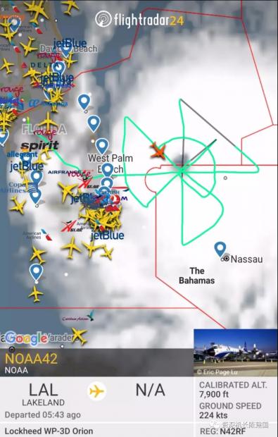
美国政府的NOAA美国国家海洋和大气管理局通常都会派出自己的飞机,飞入飓风中进行观察。
下图是发稿时还正在空中飞行的NOAA42飞机的飞行路线。
NOAA42的机型为Lockheed WP-3D Orion
大美逆行人
几天前,NOAA曾出动一个全是女飞的湾流飞机NOAA49,飞进飓风中心对飓风进行观测和数据采集。
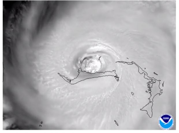
风眼是什么样子的呢?
虽然飓风是狂风暴雨摧枯拉朽的,但是和所有的热带气旋一样,在风眼都几乎是风平浪静阳光普照的。
这个是飓风从250英里以外的空间站观察是这样的:
最新的卫星云图显示,该飓风可能正在进行眼壁置换。
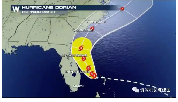
而未来预报Dorin飓风将会横扫整个美国东海岸。
飓风和台风的区别
飓风、台风都属于热带气旋。也就是由低压涡旋形成,在北大西洋和东北太平洋的叫飓风,在西北太平洋的叫台风,在印度洋的就叫热带气旋。
简单地说就是美国周边的叫飓风,亚洲附近的地区的叫台风。





 京公网安备 11010502034662号